The difference between building on the glacial till ridges of Mount Adams versus the alluvial flats along the Mill Creek Valley is not just scenic. Downtown Cincinnati rests on stiff clays and till, while neighborhoods like Oakley and the West End sit on deeper, softer deposits. A seismic microzonation study captures these contrasts by mapping shear wave velocity profiles and soil resonance frequencies. Before any large project, we integrate geophysical surveys with a MASW Vs30 survey to classify each site per ASCE 7-22. The result is a practical hazard map that tells you where amplification will hit hardest. Cincinnati lies in USGS Seismic Category C/D, so knowing your local soil class is not optional. It is the difference between a code-compliant foundation and one that shakes apart.
In Cincinnati, site class D soils can amplify bedrock motion by 2.5 times. That is the difference between damage and survival.
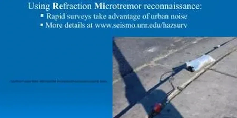
Technical details of the service in Cincinnati
Critical ground factors in Cincinnati
A common mistake we see is engineers using a single Vs30 value for an entire block in Cincinnati. The geology changes fast. One lot may have 3 meters of fill over stiff till, while the next lot has 12 meters of soft clay. Without a microzonation map, the structural design assumes uniform conditions. That leads to under-designed foundations in amplified zones and over-designed ones elsewhere. The bigger risk is liquefaction in the loose sands beneath the Ohio River floodplain. Youd-Idriss (2001) criteria applied to SPT blow counts from a single boring can miss lateral variability. Microzonation layers multiple borings, Vs profiles, and CPT data to delineate hazard zones. Skipping this step means accepting a 40% chance of differential settlement in a moderate seismic event.
This service complements our laboratory testing work for a complete project analysis.
Our services
Our seismic microzonation package for Cincinnati includes three integrated tiers, each tailored to project scale and budget.
Regional Vs30 Mapping
Passive HVSR and active MASW arrays covering up to 10 km² per campaign. Deliverables include contour maps of Vs30, site class boundaries, and fundamental frequency overlays. Ideal for neighborhood-scale developments or master-planned communities.
Site-Specific Ground Response Analysis
One-dimensional equivalent-linear analysis using DEEPSOIL or STRATA. Inputs include measured Vs profiles, strain-dependent modulus reduction curves (Darendeli 2001), and bedrock motion scaled to USGS hazard deaggregation. Output: surface acceleration spectra for structural design.
Liquefaction Hazard Zonation
SPT-based (Youd-Idriss 2001) and Vs-based (Andrus-Stokoe 2000) liquefaction triggering analysis. Mapping of liquefaction potential index (LPI) across the site. Includes recommendations for Improvement or deep foundations where LPI exceeds 5.
Quick answers
What is the difference between seismic microzonation and a standard geotechnical report?
A standard geotechnical report provides soil parameters for foundation design. Seismic microzonation specifically maps how local soil conditions modify earthquake ground motion across a site. It produces Vs30 contours, site class boundaries, and amplification factors. In Cincinnati, where soil depth varies from 3 m on the hills to 40 m in the valley, microzonation catches lateral variability that a single boring cannot.
How many measurement points are needed for a reliable microzonation in Cincinnati?
For a 5-acre site, we typically deploy 6 to 10 HVSR stations and 3 to 5 MASW lines. The spacing depends on geological complexity. In the Ohio River floodplain, where alluvium thickness changes quickly, we recommend points every 75 m. On the glacial till plateaus, 150 m spacing is sufficient. Each point is referenced to a boring or CPT for calibration.
Does Cincinnati's seismic hazard require microzonation for residential projects?
For single-family homes on shallow till, IBC 2021 prescriptive tables may suffice. But for multi-family, commercial, or critical facilities (schools, hospitals), microzonation is strongly advised. Cincinnati sits in USGS Seismic Category C/D, and site class D amplifies motion up to 2.5 times. A 2018 USGS update increased PGA values for the region, so older design spectra may be non-conservative.
How much does a seismic microzonation study cost in Cincinnati?
The typical range for a comprehensive study covering 5 to 20 acres is between US$4.090 and US$18.910. This includes field geophysics (MASW + HVSR), laboratory testing, analysis, and a final report with Vs30 maps and response spectra. Larger areas or sites requiring additional CPT soundings increase the cost. Contact our team for a scope-specific quote.