Cincinnati sits at an elevation of about 480 feet above sea level, but its real character lies underground. The city is underlain by a complex sequence of Ordovician shales and limestones — the Kope and Grant Lake formations — interbedded with glacial till and alluvial deposits from the Ohio River valley. For any construction project here, knowing where the bedrock actually is and how deep the water table sits is critical. That is where electrical resistivity and Vertical Electrical Sounding (VES) come in. These geophysical methods allow us to map subsurface layering without a single drill hole, using current injection to measure how different materials resist electrical flow. In our experience, VES surveys in Cincinnati are especially valuable for identifying buried valleys, perched water tables, and the transition from weathered shale to competent limestone. Before committing to a full borehole program, many teams start with a georadar survey to complement the resistivity data, especially in the dense urban blocks of Over-the-Rhine or Mount Adams.
A single VES line can map 50 meters of subsurface in a day — no drilling, no spoils, no restoration costs.
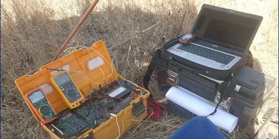
Technical details of the service in Cincinnati
- Topsoil and fill: 10–100 ohm-m (conductive clays)
- Saturated sand/gravel: 100–300 ohm-m
- Weathered shale: 30–80 ohm-m
- Competent limestone: >500 ohm-m
Critical ground factors in Cincinnati
Cincinnati sits in seismic zone 1 per IBC, with low but non-zero seismic hazard. The real subsurface risk here is not earthquakes — it is the heterogeneity of glacial deposits. Buried channels carved by the pre-glacial Teays River system can drop bedrock 30 meters deeper than adjacent areas, and old stream terraces hold pockets of loose sand that can settle under load. A VES survey catches these anomalies before foundation design is locked in. Without it, a spread footing that looks fine in one borehole could end up half on bedrock and half on fill. In our practice, we have seen VES save multiple projects in the East End and along the Mill Creek valley by routing footings away from unpredictable buried valleys.
This service complements our laboratory testing work for a complete project analysis.
Our services
Our Cincinnati electrical resistivity services cover the full workflow, from field acquisition to interpreted cross-sections.
2D Resistivity Profiling
Multi-electrode surveys along linear transects. Ideal for mapping lateral changes in soil and rock across a site.
Vertical Electrical Sounding (VES)
Depth-focused soundings at a single point. Used to determine layer thickness and resistivity with depth.
Time-Lapse Resistivity Monitoring
Repeated surveys to track changes in moisture content, leachate plumes, or groundwater elevation over time.
Integrated Interpretation Report
Correlation of resistivity data with borehole logs, CPT soundings, and MASW profiles for a unified ground model.
Quick answers
How deep can a Vertical Electrical Sounding (VES) reach in Cincinnati soils?
With standard electrode spreads up to 20 meters, VES can resolve layers to about 40–50 meters depth in the typical shale-limestone sequence of Cincinnati. The actual depth depends on electrode spacing and the conductivity contrast between layers — weathered shale (30–80 ohm-m) versus fresh limestone (>500 ohm-m) gives excellent signal.
What is the typical cost range for an electrical resistivity survey in Cincinnati?
For a standard 2D resistivity line of 200 meters with 2-meter electrode spacing, the range is between US$670 and US$1,060. This includes field work, data inversion, and a basic interpreted section. Larger areas or multi-line grids will scale accordingly.
How does electrical resistivity compare to drilling boreholes for site characterization?
Resistivity provides continuous lateral coverage at a fraction of the cost of drilling — a single VES line can cover 50 meters of subsurface in one day versus one borehole per 10 meters. However, resistivity is an indirect measurement that requires correlation with known lithology. We recommend using VES as a screening tool before drilling, then targeting boreholes to ground-truth the resistivity anomalies.